


Starter
$990 / month
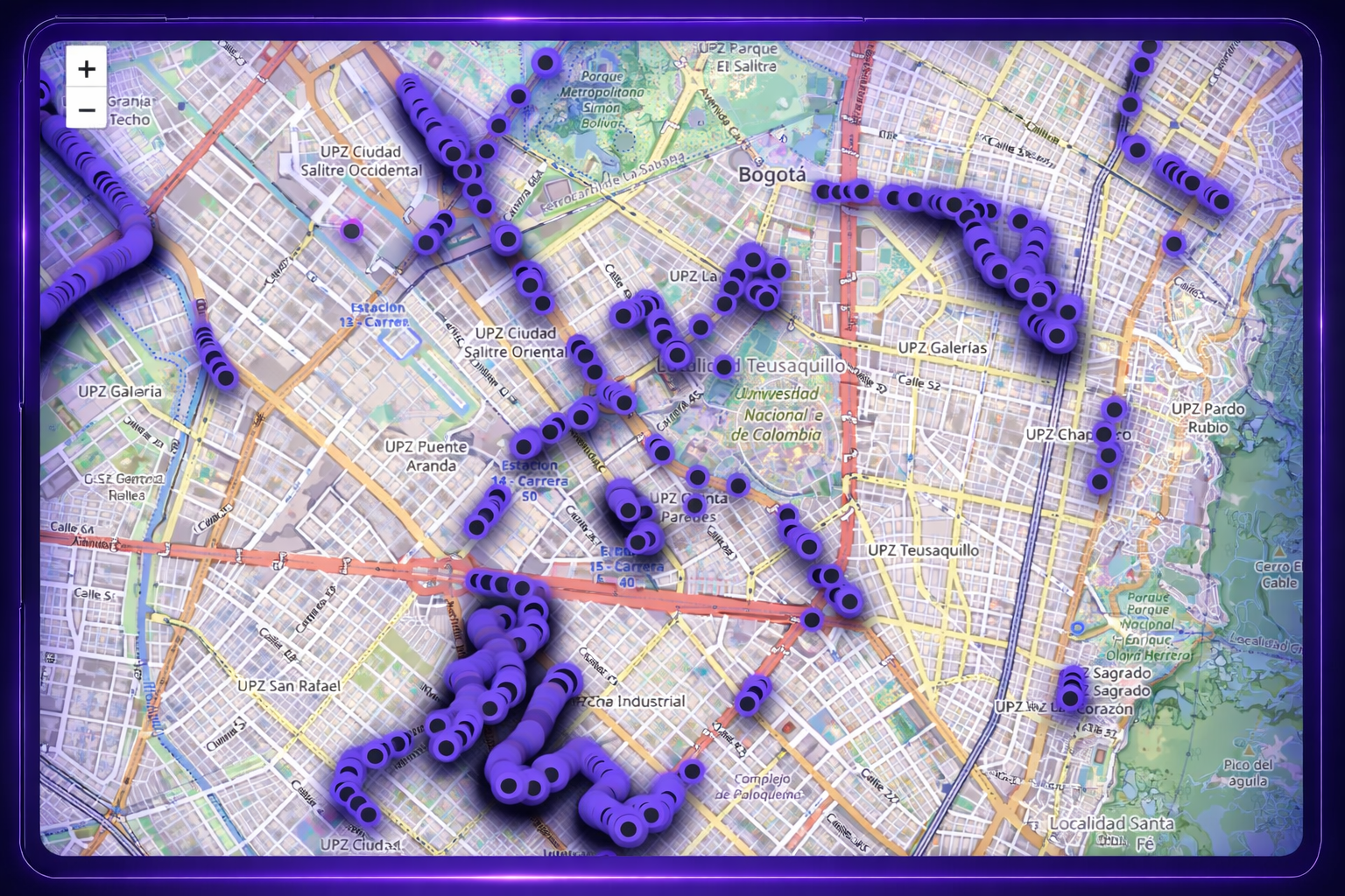
Up to 300 km
Refresh: 1× / month
- Filter by asset type, location, and State of Health
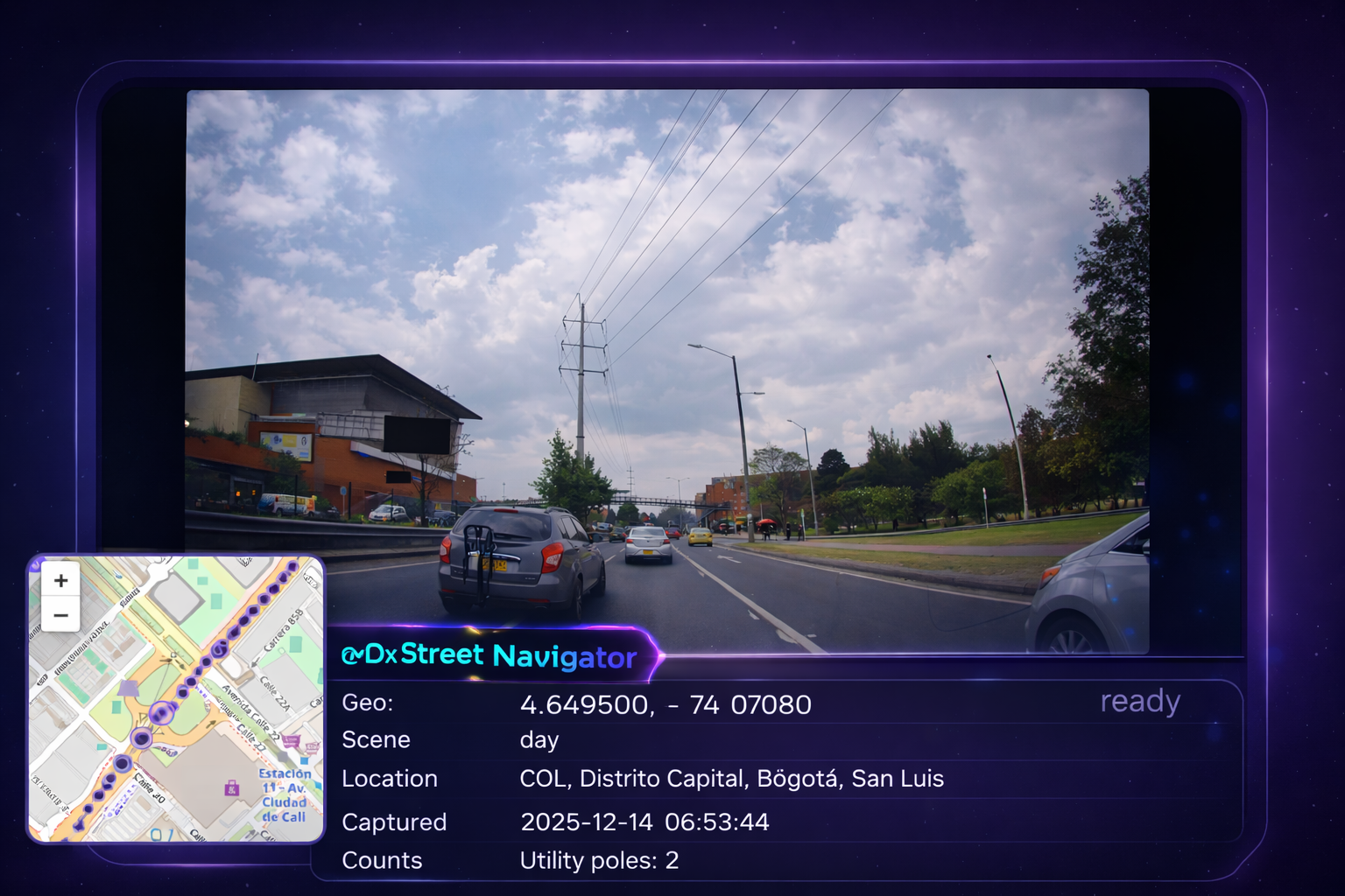
- Results list with geo-tags + timestamps
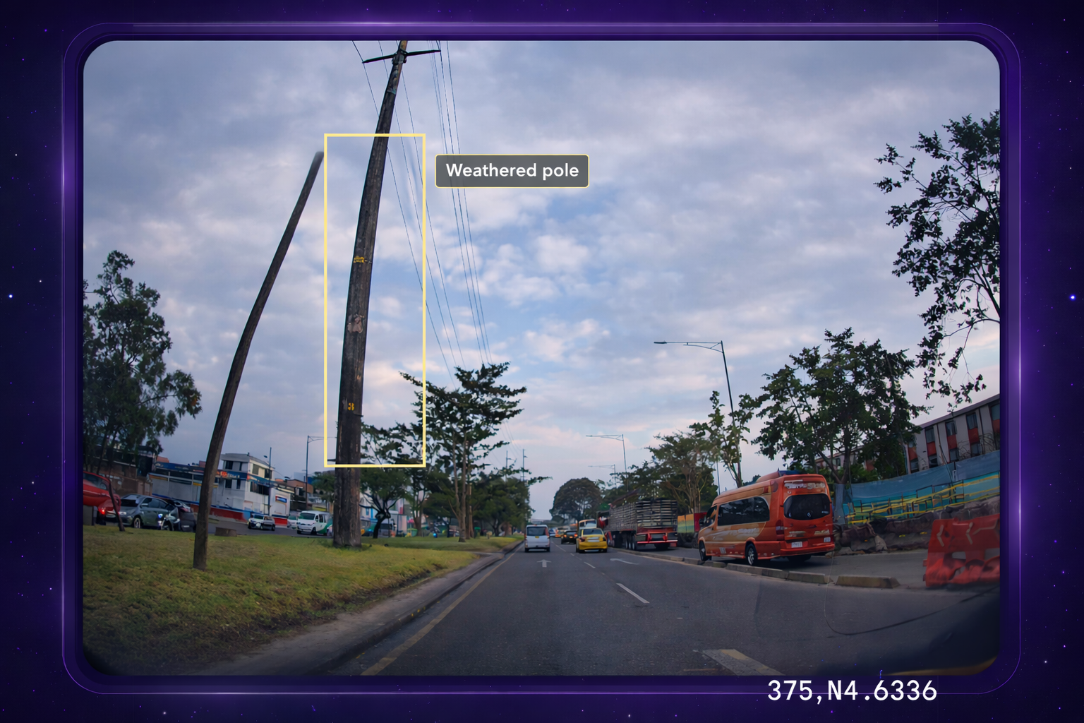
- Raw evidence frame for every result
- Filter down to neighborhood level
- Limited evidence export quota (fair-use)
- Ideal for audits, planning studies, feasibility checks, and pilot districts